Category:Maps
Jump to navigation
Jump to search
Maps of Rensselaerville
Pages in category "Maps"
The following 2 pages are in this category, out of 2 total.
Media in category "Maps"
The following 19 files are in this category, out of 19 total.
- 1787-SW10.jpg 768 × 902; 451 KB
- 1787-SW11.jpg 768 × 929; 373 KB
- 1787-SW12.jpg 768 × 957; 419 KB
- 1787-SW4.jpg 673 × 1,024; 313 KB
- 1787-SW5.jpg 976 × 1,255; 705 KB
- 1787-SW6.jpg 994 × 1,328; 874 KB
- 1787-SW7.jpg 760 × 1,024; 522 KB
- 1787-SW8.jpg 768 × 997; 536 KB
- 1787-SW9.jpg 1,049 × 1,389; 922 KB
- 350 survey.jpg 479 × 640; 249 KB
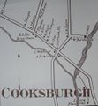
- Cooksburgh.jpg 1,015 × 1,100; 145 KB
- Image0lrgdoc.jpg 768 × 910; 208 KB
- Ren 20.jpg 900 × 464; 200 KB
- Ren 34.jpg 600 × 900; 176 KB
- SE1.JPG 720 × 960; 95 KB
- SE4.jpg 720 × 960; 87 KB
- SE7.jpg 720 × 960; 89 KB
- SW2.jpg 720 × 960; 61 KB
- SW3.jpg 720 × 960; 84 KB


