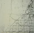
1787 map of Berne

The northern half of Wm. Cockburn's 1787 map of the Western Manor of Van Rensselaer covers all of what are now the Towns of Berne and Knox. The southern half of the map is of Rensselaerville and Westerlo. Photostat sheets were made in the 1930s or 40s of the original map in the NYS Library Manuscripts and Special Collections Division in Albany. The digital images posted here were taken made by Harold Miller in June 2009 of the photostat copies and were manipulated in an attempt to sharpen the images.
Here are digital images of the photostat copies of the southern section of the northern half of the map that covers all of what is now the Town of Berne.

The 1866 map above is keyed to the sheets below. The sheets below are in the same order as in the key going from left to right and top to bottom. Sheet SW2 in the south west corner of Berne, (Huntersland), is not shown on the key. It is off the map to the lower left.
The great lot numbers are the same on both the 1866 key map and the 1787 map. For the history of individual lots, go to Berne Lots.
Close up sections
- West of Warner's Lake - A portion of the map west of Warners Lake
- Northwest of the hamlet of Berne
Map Images
sheet 3W
(west of sheet 3)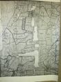
sheet 3 
sheet 7 
sheet 11 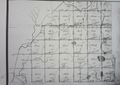
sheet 4W
(west of sheet 4)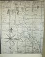
sheet 4 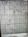
sheet 8 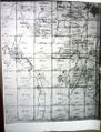
sheet 12 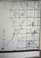
sheet SW2
(not shown on key; to the west of SW3)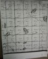
sheet SW3 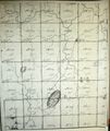
sheet SE1 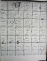
sheet SE2 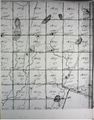
sheet SE3


