1787 map of Westerlo

The northern half of Wm. Cockburn's 1787 survey map of the Western Manor of Van Rensselaer covers all of what are now the Towns of Berne and Knox. The southern half of the map is of Rensselaerville and Westerlo. Photostat sheets were made in the 1930s or 40s of the original map in the NYS Library Manuscripts and Special Collections Division in Albany. The digital images posted here were taken made by Harold Miller in June 2009 of the photostat copies and were manipulated in an attempt to sharpen the images.
Here are digital images of the photostat copies of the souteastern quarter of the map. It is on 12 sheets. It is 3 sheets wide and 4 sheets high. Here is the key to the sheets as numbered by the NYS Library:

Unfortunately I accidentally saved an image over sheet SW11 so it is not available.
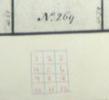
key 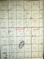
sheet SE1 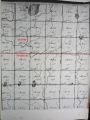
sheet SE2 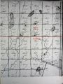
sheet SE3 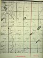
sheet SE4 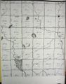
sheet SE5 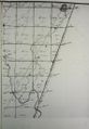
sheet SE6 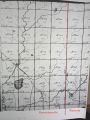
sheet SE7 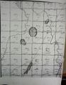
sheet SE8 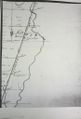
sheet SE9 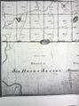
sheet SE10 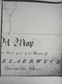
sheet SE12


