Farms and Lots
- Current Farms - For a listing of current farms, farm products and farm activities go to Rensselaerville visitor attractions and facilities.
- Historic Farms - The historic farms are in order by Van Rensselaer Great Lot number which tells approximately (and often precisely) which grid on Beers 1866 map the farm is located. Click here an explanation of the 1866 Beers map.
The Rensselaerville Lot Numbers were assigned by Wm. Cockburn when he made his 1787 survey map of the Hilltowns. It is based on a grid a half mile across. This made the typical lot 1/4 square mile (160 acres). The number of the grid is the same as the number of the lot for vacant land. The lots of the squatters who were already there at the time of the survey are irregular in shape and cross grid boundaries.
The purpose of this site is to tell the story of each farm from the first homesteader to the present. Pictures may be used provided you have authority to post them.
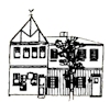
HISTORIC HOMES
Tell the story of each historic home, when it was built, who lived there, additions, remodeling. Organized by Lot number. Pictures may be used provided you have authority to post them.
- Rensselaerville visitor attractions and facilities has a listing of historic homes for viewing from the road.
- Watson House