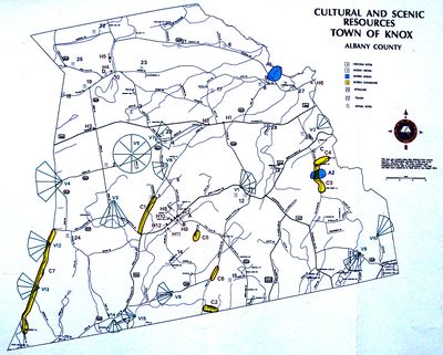
Numbered list of cemeteries and locations that matches above transcriptions
Jump to navigation
Jump to search
The locations of the cemeteries are as follows: (See map below for locations)
- A. Knox Cemetery - East of Knox on Route 156.
- B. Old Knox Cemetery - Route 156 across from Knox Firehouse.
- C. High Point Cemetery - Corner of Route 156 and Old Stage Road.
- D. Lee's Church Cemetery - Knox Cave Road, two miles north of Route 146.
The locations of family cemeteries are:
- 1. Saddlemire Road, first hedge-row on left side.
- 2. North side of Middle Road., .2 mile east of Beebe Road.
- 3. Nash Road, .2 mile north of Route 146, on west side of the road beside Nature Conservancy.
- 4. Van Auken burial site, on east side of Knox Cave Road.
- 5. Stan William's Farm, on east side of Knox Cave Road.
- 6. White Road, behind White farm house.
- 7. Bozenkill Road , on the north bank between Pulliam's home and the Van Buren farm.
- 8. Quay Road, southeast of the Helderberg Rod & Gun Club.
- 9. Corner of Quay and Bell Roads, across from the pond.
- 10. Knox Cave Road, on the Feldman property, west of West Wind Road.
- 11. Route 156, across from Witter Road.
- 12. Pleasant Valley Road, on State Property (Old Bardkley Farm) off Route 156.
- 13. Route 156, west of the Altamont Reservoir (across from the dam bridge).
- 14. Zimmer Road, Schoonmaker burial site, southeast of Crounse Road.
- 15. At the end of Gibb's Road, off Knox Cave Road.
- 16. Church Road, near the Town line.
- 17. Quay Road, on right side one mile north of Route 146.
- 18. Ketcham Road, near Ketcham's farm on old Brunk farm (site destroyed) .
- 19. Church Road, on the Lewis farm, on the north knoll near junction of Beebe Road.
- 20. Colliton Road, one mile off Bozenkill Road on Ostrander farm.
- 21. South side of Bozenkill Road, on Peterson farm (old Snyder farm).
- 22. Bozenkill Road, .5 mile west of West Wind Road (old Williamson farm).
- 23. Craven Road, on Price property (old Quackenbush farm).
- 24. Knox-Gallupville Road, 1.5 miles from village on Whipple property (site destroyed).
- 25. Knox Cave Road, .7 mile north of Lee's Church (old Burman's farm).
- 26. Lewis Road, Strnad property (old Keenholts and Lewis farms).
- 27. North side of Bozenkill Road, 300 ft. east of D & H Railroad.
- 28. South side of Route 146, Dees' property (old Lawyer farm).
- 29. North side of Middle Road, 400 ft. east of Knox Cave Road.
List courtesy of Dan Driscoll, Knox.
