Difference between revisions of "1854 map"
Jump to navigation
Jump to search
JElberfeld (talk | contribs) m (Created page with "350px|thumb|center|<center>Central Knox, 1854</center> Knox 1854. Upper center is the intersection of Berne Altamont Road and Thompson's Lake Road. There w...") |
JElberfeld (talk | contribs) m |
||
| Line 1: | Line 1: | ||
| − | [[File:Knox 1854.jpg|350px|thumb|center|<center>Central Knox, 1854</center>]] | + | [[File:MapLogo.jpg|50px|right|link=Maps|Back to Maps]][[File:Knox 1854.jpg|350px|thumb|center|<center>Central Knox, 1854</center>]] |
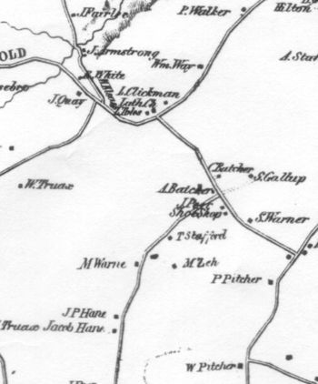
Knox 1854. Upper center is the intersection of Berne Altamont Road and Thompson's Lake Road. There was a Lutheran church there. | Knox 1854. Upper center is the intersection of Berne Altamont Road and Thompson's Lake Road. There was a Lutheran church there. | ||
[[Category:All Images]][[Category:Maps]] | [[Category:All Images]][[Category:Maps]] | ||

