File:NY Beaverdam 1757 Map.jpg
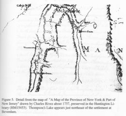
Revision as of 12:53, 9 October 2012 by JElberfeld (talk | contribs) ("A Map of the Province of New-York & Part of New Jersey" drawn by Charles Rivez about 1757. The Huntington Library, San Marino, California. Thompsons Lake is shown to the east of Beaverdam Category:All Images Category:Maps)

Size of this preview: 650 × 599 pixels. Other resolutions: 260 × 240 pixels | 1,992 × 1,836 pixels.
Original file (1,992 × 1,836 pixels, file size: 561 KB, MIME type: image/jpeg)
"A Map of the Province of New-York & Part of New Jersey" drawn by Charles Rivez about 1757. The Huntington Library, San Marino, California. Thompsons Lake is shown to the east of Beaverdam
File history
Click on a date/time to view the file as it appeared at that time.
| Date/Time | Thumbnail | Dimensions | User | Comment | |
|---|---|---|---|---|---|
| current | 12:53, 9 October 2012 | | 1,992 × 1,836 (561 KB) | JElberfeld (talk | contribs) | "A Map of the Province of New-York & Part of New Jersey" drawn by Charles Rivez about 1757. The Huntington Library, San Marino, California. Thompsons Lake is shown to the east of Beaverdam Category:All Images Category:Maps |
You cannot overwrite this file.
File usage
The following page uses this file: