Difference between revisions of "File:Colehill-1-.jpg"
Jump to navigation
Jump to search
JElberfeld (talk | contribs) (Topo map showing location on Cole Hill of Skiland.<ref>[http://www.nelsap.org/ny/skiland.html Lost New York Ski Areas]</ref> Category:All Images Category:Maps) |
JElberfeld (talk | contribs) m |
||
| Line 1: | Line 1: | ||
| − | Topo map showing location on Cole Hill of Skiland.<ref>[http://www.nelsap.org/ny/skiland.html Lost New York Ski Areas]</ref> | + | Topo map showing location on Cole Hill of Skiland.<ref>[http://www.nelsap.org/ny/skiland.html Lost New York Ski Areas]</ref><references/> |
[[Category:All Images]] [[Category:Maps]] | [[Category:All Images]] [[Category:Maps]] | ||
Latest revision as of 14:14, 25 October 2012
Topo map showing location on Cole Hill of Skiland.[1]
File history
Click on a date/time to view the file as it appeared at that time.
| Date/Time | Thumbnail | Dimensions | User | Comment | |
|---|---|---|---|---|---|
| current | 14:13, 25 October 2012 | 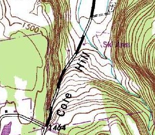 | 305 × 265 (47 KB) | JElberfeld (talk | contribs) | Topo map showing location on Cole Hill of Skiland.<ref>[http://www.nelsap.org/ny/skiland.html Lost New York Ski Areas]</ref> Category:All Images Category:Maps |
You cannot overwrite this file.
File usage
The following page uses this file: